This functions eliminates points falling inland by using st_difference() function from the sf package.
Arguments
- x
A data.frame containing latitude and longitude coordinates of vessels tracks to be cleaned by land area
- mx_inland
is a shapefile loaded with the packages representing inland Mexico area, it can be uploaded with
data("mx_inland)
Details
Points falling inland in Vessel Monitoring System, VMS, dataset are obvious mistakes, thus need to be eliminated from the data.
The function calls a stored shapefile mx_inland which is a custom sf object
created using a coastline buffer to avoid eliminating points because of lack of
precision within the shapefiles.
The function works with any dataset containing coordinate points in crs = 4326
and named latitude and longitude. See first example with a
non-VMS dataset.
A second example below shows the usage on VMS sample data.
Warning
This function takes a while!! To test you can use the dplyr::sample_n() function as it is shown in the example.
Examples
# with non VMS data
x <- data.frame(
longitude = runif(1000, min = -150, max = -80),
latitude = runif(1000, min = 15, max = 35)
)
data("mx_inland")
x <- clean_land_points(x, mx_inland)
#> Spherical geometry (s2) switched off
#> although coordinates are longitude/latitude, st_union assumes that they are
#> planar
#> although coordinates are longitude/latitude, st_difference assumes that they
#> are planar
#> Warning: attribute variables are assumed to be spatially constant throughout all geometries
# using sample_dataset
data("sample_dataset", "mx_inland")
vms_cleaned <- vms_clean(sample_dataset)
#> Cleaned: 969 empty rows from data!
vms_no_land <- clean_land_points(vms_cleaned, mx_inland)
#> although coordinates are longitude/latitude, st_union assumes that they are
#> planar
#> although coordinates are longitude/latitude, st_difference assumes that they
#> are planar
#> Warning: attribute variables are assumed to be spatially constant throughout all geometries
# You can check the results by plotting the data
vms_cleaned_sf <- sf::st_as_sf(vms_cleaned, coords = c("longitude", "latitude"), crs = 4326)
vms_no_land_sf <- sf::st_as_sf(vms_no_land, coords = c("longitude", "latitude"), crs = 4326)
library(ggplot2)
ggplot(vms_cleaned_sf) +
geom_sf(col = "red") +
geom_sf(data = vms_no_land_sf, col = "black")
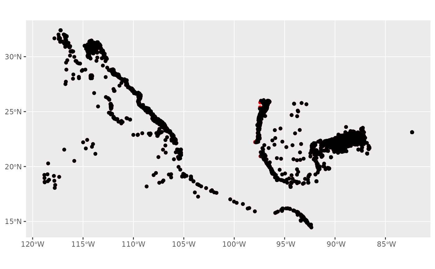 # in the provided example only few inland points are eliminated.
# There are more evident one within historical data.
# in the provided example only few inland points are eliminated.
# There are more evident one within historical data.